
Barcelona - die wundervolle Stadt am Mittelmeer
Jede Menge Informationen über Barcelona - hier Tickets, Führungen, Rundfahrten und mehr buchen
Wir freuen uns, Sie auf Barcelona.de begrüßen zu dürfen und laden Sie herzlich dazu ein, sich auf unseren Seiten über das Reisen nach Barcelona zu informieren. Wir geben Ihnen gerne Tipps für Ihren Urlaub oder Kurztrip.
Barcelona - Einfach mehr erleben
Lassen Sie es sich gut gehen: Barcelona ist eine super spannende Stadt. Unzählige Sehenswürdigkeiten laden Sie zu einer Besichtigung ein, ein breites kulturelles Angebot wird Sie begeistern und während spannender Führungen und Stadtrundfahrten lernen Sie die verborgenen Plätze kennen. Wie kaum eine andere Stadt bietet Ihnen Barcelona eine kulinarische Vielfalt. Sie mögen Natur? Kommen Sie zu uns, Katalonien verfügt über eine einzigartig schöne Landschaft und liebenswerte Städtchen, die einen Ausflug lohnen.
Besichtigungen
Stadtführungen
Stadtrundfahrten
Mobil in Barcelona
Barcelona aktiv

Direkt zu unseren Bestsellern
Sie finden auf Barcelona.de fast alles, was Sie für eine Reise brauchen: Hotels, Tickets, Führungen, Transfers, Ausflüge, Abendveranstaltungen und vieles mehr. Dazu noch viele Informationen und Tipps.
Hier haben wir unsere Bestseller aufgelistet:

- Freie Nutzung ÖPNV
- Transfer Flughafen in die Stadt
- Viele kostenlose und ermäßigte Eintritte
- Eintritte ohne Anstehen

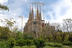
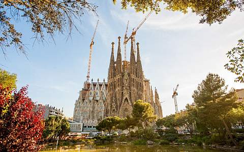
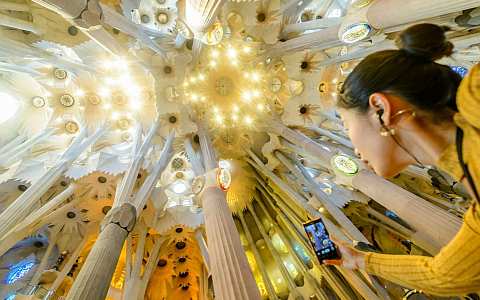
Sagrada Familia Tickets und Führungen
- Tickets für den Eintritt ohne Anstehen
- Führungen innen und außen
- Auch deutschsprachige Führungen
- Die Top-Sehenswürdigkeit in Barcelona

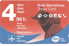
Hola BCN - Mehrtagesticket ÖPNV
- Ein Ticket für die öffentlichen Verkehrsmittel
- Für 48, 72, 96, 120 Stunden
- Flughafen enthalten
- Unbegrenzte Anzahl an Fahrten

FC Barcelona Camp Nou besichtigen
- Ticket Camp Nou, Europas größtes Stadion
- Kein Anstehen an der Kasse nötig
- Blick hinter die Kulissen
- Inklusive Museum des FC Barcelona

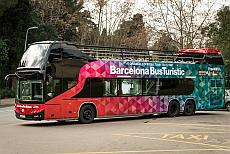
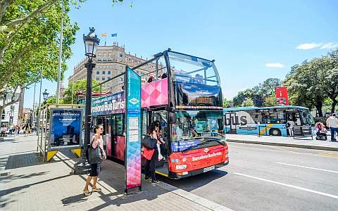
Tickets für die Cabriobus-Stadtrundfahrt
- Tickets für 1-2 Tage
- Audioguide inklusive
- Beliebig oft ein- und aussteigen
- Ganzjährig in Betrieb

- Tickets für den Eintritt in das Casa Milà
- Beeindruckende Architektur
- Weltkulturerbe der UNESCO
- Tages- und Abendtickets

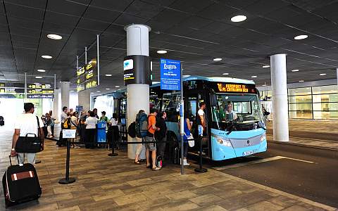
- Komfortabler Bustransfer
- Von allen Terminals von Barcelona BCN
- 24/7 in Betrieb
- Fahrtdauer ca. 35 Minuten in die Innenstadt

Ausflug zum Kloster Montserrat
- Tickets für den Transfer
- Ausflug zum Montserrat
- Beeindruckende Landschaft
- Genießen Sie das Kloster und die Berge

- Tickets für Transfer von Girona Flughafen
- Komfortabler Bus
- Kostenloses WLan an Bord
- Fahrplan auf Ryanair Flugzeiten abgestimmt

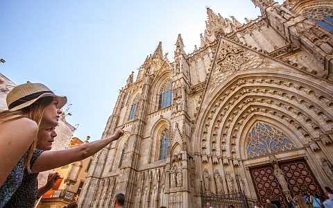
Stadtführungen im Gotischen Viertel
- Stadtführungen im Gotischen Viertel
- Auch auf Deutsch buchbar
- Private und offene Führungen
- Spannender Stadtteil

- Private und offene Segway-Touren
- Auch auf Deutsch buchbar
- Viel Spaß und schnell zu lernen
- Auch auf den Montjuïc

- Tickets für den Eintritt
- Tickets für Führungen
- Eintritt ohne Schlange stehen
- Einer der schönsten Parks in Barcelona
Ihr Hotelzimmer in Barcelona buchen. Alle Kategorien.
Apartments, 1-5*-Hotels, Hostels.